blah blah blah
Mts. Pickering and Stanton
Length: 4.6 miles out-and-backDifficulty (click for info): Moderate
Elevation Gain: 1570 feet (+280 feet on return)
Rating (click for info): 7/10
Elevation: 1939' (Pickering) and 1718' (Stanton)
Prominence: 203' (Pickering) and 249' (Stanton)
Driving Directions:
Trailhead and parking area are on Covered Bridge Lane in Bartlett, NH. From Rt. 302, 1.7 miles west of the junction with Rt. 16 in Jackson, turn west onto Covered Bridge Lane. Drive a quarter mile and bear left to stay on the loop road around the neighborhood. Drive another 0.7 miles to the trailhead. You will see the trail sign just before the driveway to a log house on a rightward bend in the road. You will want to park on the left side of the road, before the sign. Click here for a Google map.
About the Hike:
Situated at the trailing end of the the Montalban Ridge, which runs south from Mt. Washington through the remote Dry River Wilderness, the two peaks of Mt. Pickering and Mt. Stanton overlook the confluence of the Rocky Branch and the Saco River. Drivers in transit from Crawford Notch to Bartlett will notice the striking cliffs of Mt. Stanton's Whites Ledge across the river. At a humble elevation beneath 2000 feet, the two summits are patterned with scenic ledges and red pine forest lending them stunning views over the river valleys. The low-altitude view makes them ideal for fall foliage viewing, and they are in a less crowded area of the Presidential Range. The hike is never too arduous and remains entertaining with a variety of scenic sights.
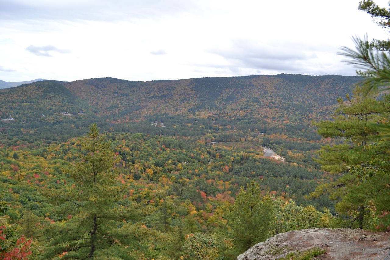
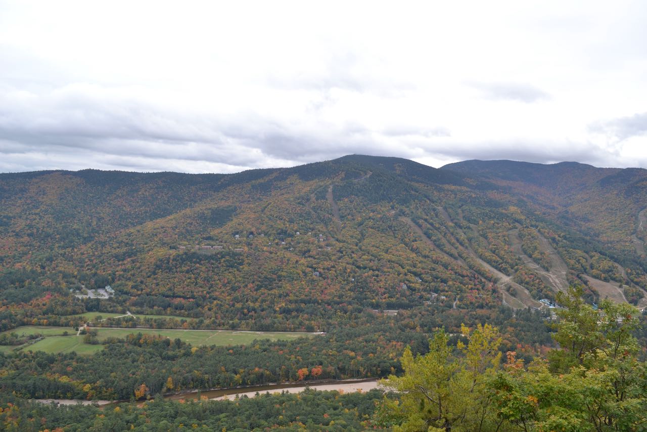
From your residential starting point, walk up to the trailhead and follow the path right beside one of the driveways and into the woods. With the cliff face of the Whites Ledge between you and the summit, the trail bends around to the right, staying in the vicinity of the houses and winds upward gradually. Around 0.35 miles in, the trail makes a left turn, sneaks by a house in a separate neighborhood, and makes another left turn in 0.1 miles (pay attention to stay on the trail and not follow the blazed boundary line straight). The trail proceeds straight ahead and, after a quarter mile, surmounts a steep climb where the footing has been quite worn out from many footsteps. You reach the top of the main ridge in 0.1 miles, and the path turns left and follows close by the increasingly precipitous edge. Trapse across scattered ledges underneath towering conifers for 0.2 miles to reach the viewpoint on Whites Ledge. From here you enjoy a lovely view over the Bartlett valley to the peaks beyond. You look out over the center of Glen village underneath the cliffs of Thorn Mountain, with majestic Kearsarge North and its fire tower standing behind to the right. Smaller summits in the range, the Twins and Mt. Shaw, trail off to the left of it. To the right is the Green Hills range. Several sections of the Saco River making its trip through Bartlett can be seen. Straight across the river valley is the Attitash Ski Area, with Big Attitash and North Moat Mountains behind it. To the right of the ski trails is Bear Mountain.
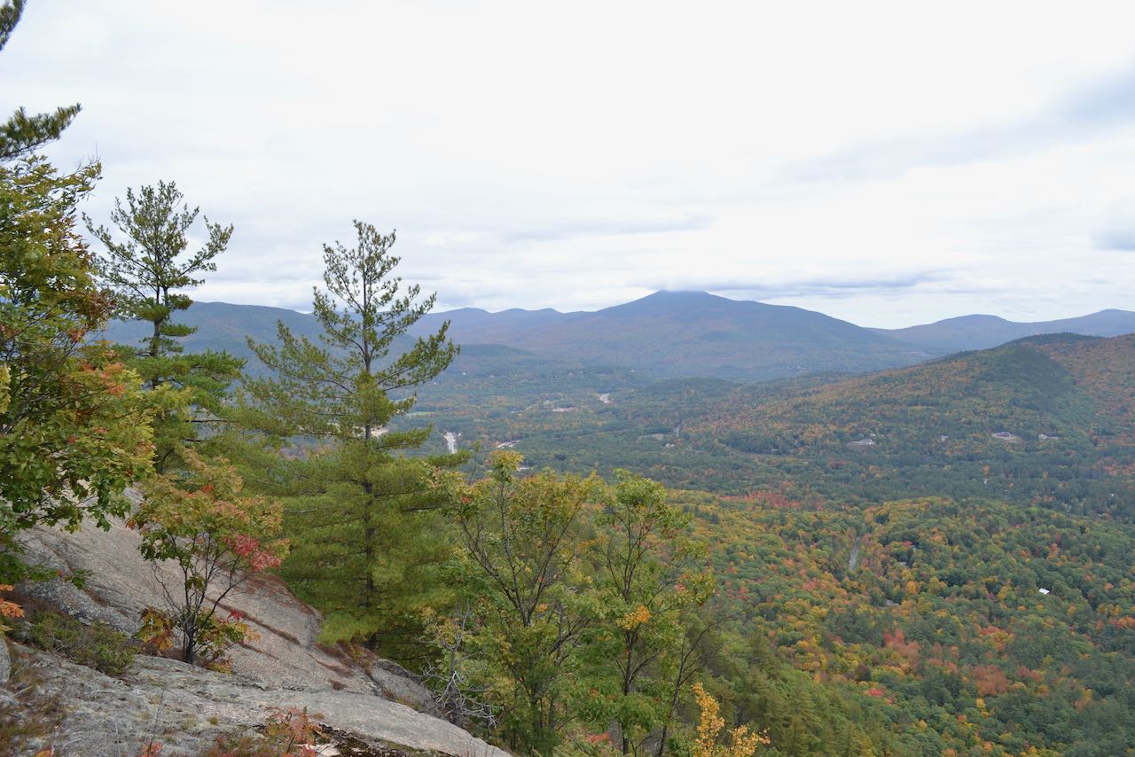
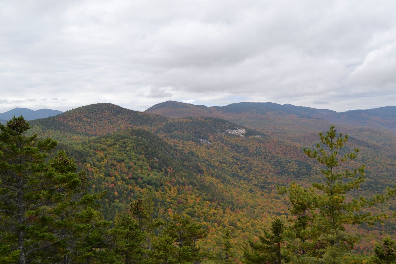
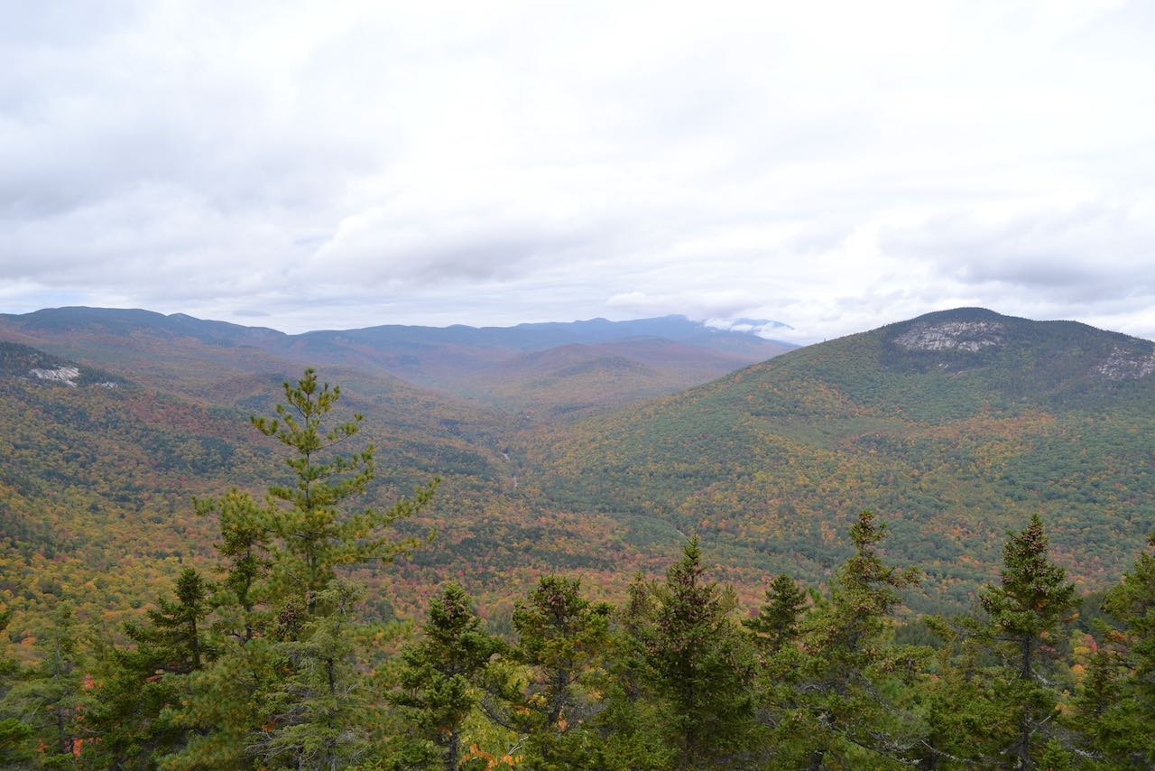
The trail continues to follow the sharp ridge top for 0.3 miles, passing by a notable boulder, then climbs up a steeper and rockier section for 0.1 miles to emerge on the Mt. Stanton ledges. Several good outlooks are passed as the trail heads across the rock toward the summit. The view surveys the same terrain as the Whites Ledge outlook, but from a higher angle. More of the Green Hills can now be seen over the long ridge extending from Little Attitash, including Hurricane Mountain, Black Cap, and Middle Mountain. There is also a tremendous view of the Saco River now. The trail meanders across these ledges and reaches the summit in another 0.15 miles, where more ledges provide a view through the trees north across the Rocky Branch valley to the cliffs of Iron Mountain and out to Wildcat Mountain and Carter Dome. The trail descends north 0.1 miles past another opening with a nice view to Thorn Mountain, the Doubleheads, and the Baldface Range to another ledge (walk straight ahead a bit as the trail takes a left turn) with a more open view. This secluded point opens up a panorama stretching from the Kearsarge North range past the aforementioned Doubleheads and Iron Mountain across to the Rocky Branch Valley, with the upper Montalban Ridge and part of the Southern Presidentials behind. This perspective will be improved from Mt. Pickering.
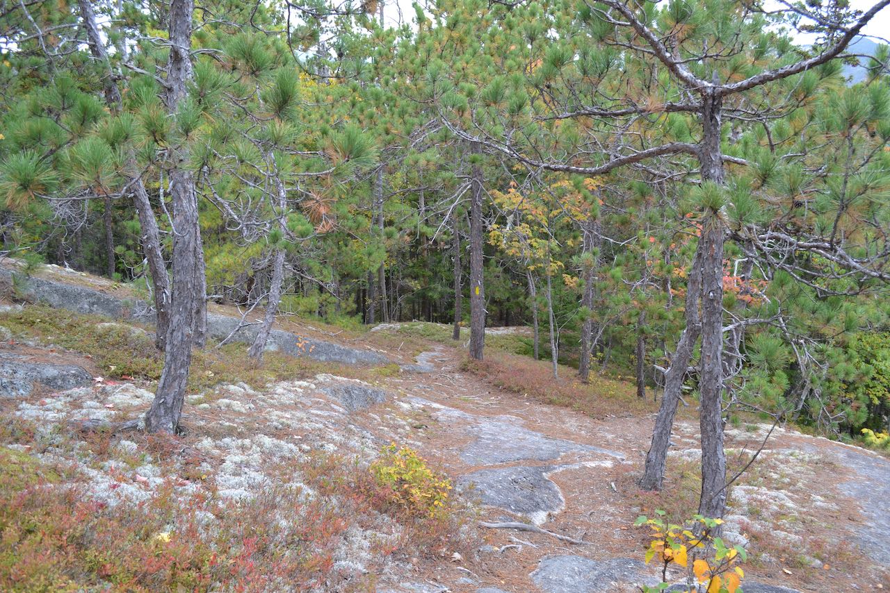
As the trail takes its left turn from the ledge, drop steadily through the whimsical environment of low blueberries and clinging red pines. The trail slips back into the forest and descends 0.2 miles to the low point between the two mountains. Then, it begins to climb again, not taking long to find its way into more ledgy areas. Ascending moderately through scattered rocks and small cliffs, the trail makes a single switchback in 0.3 miles from the col, and passes just beside the summit in another 0.15 miles. If you look closely in the highest point in the woods to the left of the trail, you will see a summit register jar on one of the trees. Just beyond the summit, the trail comes out to a spectacular viewpoint looking straight up the Rocky Branch valley. Now, you can see the entire Montalban Ridge, continuing past this mountain over Mt. Langdon, with its prominent ledge-scarred shoulder, to curl up over the dome of Mt. Parker, broad-crested Mt. Resolution, cliff-faced Stairs Mountain, and then beyond over the lengthy stretches of Mt. Davis and Mt. Isolation, all the way up to Mt. Washington. Mt. Monroe and Mt. Franklin can be seen of the Southern Presidentials to the left of Washington. Over the trees all the way to the left, you can see some of the Nancy Range. Iron Mountain is still in frame over to the right, with the Wildcats and Carters to the right, as well as the long ridge of Black Mountain, with the small ski area at the end. Moving around, you can get the same view of the Baldfaces and Doubleheads that you saw previously as well.
Printable directions page